11 JOHNSON ST
Owner Information
THERESIAS JOSEPH
11 JOHNSON ST
BROCKTON, MA 02301


Property Details
11 JOHNSON ST is classified as a Single Family Residential (3:colonial).
The primary structure on this property was built in 1925. There is 1,840ft2 of residential/living space within this property. This property is listed as having 8 rooms.
11 JOHNSON ST is valued at $357,900. The land is valued at $79,000 and the structures are valued at $278,900. There is an additional valuation of $10,530 on this property.
This property is in Zone R1C. Confirm with local Zoning Board authorities to ensure there are no overlays or other easements on this property.
The most recent deed for 11 JOHNSON ST is recorded at the local registrar in Book 38976, Page 211. 11 JOHNSON ST was last sold on Wednesday, September 15, 2010 for $1.
Assessment data from fiscal year 2021.
Flood Data
According to the FEMA National Flood Hazard Layer, this property does not appear to be in a flood zone. It may also be in an area not yet reviewed. Nonetheless, confirm this information prior to taking any action.
To view the flood hazards around this property, create a FEMA "Firmette" Map of the area around 11 JOHNSON ST.
Broadband Internet Providers
| Provider | Type | Bandwidth (mbps) | |
|---|---|---|---|
| HughesNet | Satellite | 25 | 3 |
| GCI Communication Corp. | Satellite | 0 | 0 |
| Viasat Inc | Satellite | 100 | 3 |
| Comcast | Cable | 1000 | 35 |
| Verizon New England Inc. | DSL | 7 | 0 |
| VSAT Systems, LLC. | Satellite | 2 | 1 |
Broadband service provider data from December 2020.
Adjacent Properties
- 208 MENLO ST
Single Family Residential owned by HERNANDEZ DAVID - 15 JOHNSON ST
Single Family Residential owned by MEZOFF DAVID A - 12 MENLO AV
Single Family Residential owned by LEIGHTON JAMES E - 16 MENLO AV
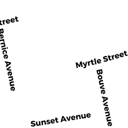
Single Family Residential owned by MCEWAN MARION S - 135 BOUVE AV
Single Family Residential owned by VEIGA EDWARD - 222 MENLO ST
Single Family Residential owned by MORALES EDGARDO LUIS - 216 MENLO ST
Single Family Residential owned by JOSEPH BATH SHEBA